


- Meadow Creek is a moderate hike that passes through the Upper Blue Valley, with the option to stop early at Lily Pad Trail.
- Tenderfoot Mountain is an easy trail, meandering through fields of wildflowers as well as forests.
- The short Mount Royal Trail passes by the mining settlement of Masontown before heading to the summit.
Overview
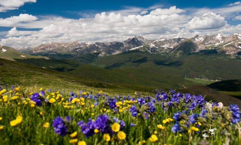
Summit County has a higher than average number of “14ers,” or mountains above 14,000 feet elevation. This creates a variety of environments to explore, from the spring snowmelts that raise the creeks to the pine forests that give way to the tundra above the timberline. Fortunately, Breckenridge hiking trails go all over, crisscrossing the entire area, allowing access to most any part of the surrounding mountains.
These Breckenridge hikes provide the opportunity to get out for some exercise in the high alpine air. Make sure you drink plenty of water because the thin air will take the moisture right from your pores!
Where to go Hiking / Backpacking
Trail Maps
- Summer Hiking & Biking Trails at Breckenridge Ski Resort
- Nearby Trails (and trailheads)
- Detailed Town Map with Trails
Tenderfoot Mountain
This is an easy trail that takes hikers through meadows of wildflowers and forests of aspens and lodgepole pines.
- Trailhead: Located off Hwy 6, south of I-70 exit 205. Look for Evergreen Road, then a quick turn onto Straight Creek Road, which will lead to the parking area.
- Distance: 1.8 miles
- Elevation Gain: 621 feet
- Level of Difficult: Easy
Mount Royal Trail
This trail heads to the summit of Royal Mountain. You will pass the old mining settlement of Masontown after .91 miles, so be sure to take a look around before heading up.
- Trailhead: Approximately 140 yards east of I-70 exit 201 on Main St.
- Distance: 2 miles one-way
- Elevation Gain: 1,372 feet
- Level of Difficult: Moderate
Lenawee Trail
This hike will take you up into the mountains to get a spectacular view of Lake Dillon as well as Jumbo Mine. Pay attention to the cairns when you get above the timberline.
- Trailhead: Off Peru Creek Rd, which is accessible from Montezuma Road outside Keystone.
- Distance: 3.8 miles one-way
- Elevation Gain: 1,786 feet
- Level of Difficult: Moderate
Meadow Creek
Views of the Upper Blue Valley poke through the aspen groves on this hike. For those who aren't up to the long out-and-back, consider turning off at the Lily Pad Trail, which is a small 1.3 miles from the trailhead.
- Trailhead: Located on the north frontage road at exit 203 of I-70.
- Distance: 4.6 miles one-way
- Elevation Gain: 1,600 feet
- Level of Difficult: Moderate
Wheeler National Recreation Trail
Crossing valleys, over saddles, through forests, this trail give incredible views of the Gore Range, Ten Mile Range and even the Sawatch Range. Be prepared for all types of weather, because much of the trail is above timberline.
- Trailhead: Either from Wheeler Junction or the top of Hoosier pass, where the Continental Divide crosses.
- Distance: 14 miles one-way
- Elevation Gain: 1,911 feet
- Level of Difficult: Difficult
Rentals and Fees
Outdoor shops in town will be able to rent backpacks, tents, stoves and other gear for those hikers tackling multiple day adventures.
Some parking areas have fees associated with them, but most are free of charge.
Hire a Guide
Have you ever been on a trail and wondered, “What animal makes those tracks? What type of plant is this? Where did the trail go?” Hiring a Breckenridge, Colorado hiking guide will solve all those problems, so consider taking along a professional for your trip.
Outdoor stores will be able to arrange for a guide to accompany you.
